
Tigard Neighbors Through Parcel Records
Public sources around a Tigard address answer different questions. A Tigard map can locate the subject tax lot and its surrounding geometry. The Tigard assessment record may show an owner and mailing address. A civic boundary map can identify a named Tigard neighborhood area. None of those sources creates a Tigard household roll. Begin with the source that matches the question, preserve its identifiers and date, and avoid treating an owner record as proof of resident occupancy.
| Source | What It Shows About a Block | Access |
|---|---|---|
| Tigard advanced map | Address, street, unit, tax-lot location, visible parcel geometry, city and neighborhood-boundary context | Public city web map |
| Washington County WashcoTax for Tigard parcels | Parcel identifiers, situs, legal description, assessment owner and mailing address, values, improvements, and sales history | Free county property search |
| Washington County InterMap for Tigard | Property, sales/deed, value, and improvement detail through its Assessment & Taxation subreport | County map and property research route |
| Tigard active-permits service | Current project placement, case details, tax-lot ID, dates, and applicant or work context | Public active layer; not a household record |
| Tigard neighborhood map and Engage choices | Geographic civic areas such as Bull Mountain, Downtown, River Terrace, and West Tigard | Public city resources; not a membership roster |
| Tigard Neighborhood Watch participation materials | Private coordinator contacts and local maps for participating blocks | Program participation, not a city-published directory |
WashcoTax is an assessment and property tool for Tigard parcels. A Tigard result can show a current owner or taxpayer mailing address that differs from the parcel’s situs address. Trusts, estates, businesses, and nonresident owners can appear there. Record it as assessment information, then use the legal description, map number, sales date, buyer, seller, and instrument number only for the next official records step. That preserves the difference between a Tigard parcel record and evidence about who occupies it.
Tigard Neighbors Start With City Map Searches
The Tigard advanced map offers several ways to locate the Tigard subject area before any adjacent parcels are reviewed. Its published search categories are Address, Unit Number, Common Places, Tigard Intersection, Tigard Street, and Tigard Area Tax Lot. The map supplies Tigard geographic context such as parcels, city and neighborhood boundaries, zoning, plats, annexations, historic overlay, flood data, permits, and code-compliance layers. It is a Tigard locator and context tool, not ownership proof.
| Tigard Address | Locate the Tigard subject property by address text or autocomplete. |
|---|---|
| Tigard Unit Number | Use when known to refine a Tigard location; it does not identify occupants. |
| Tigard Intersection | Use a street pair to orient a block before selecting a parcel. |
| Tigard Street | Locate a route or segment, then inspect the map’s parcel context. |
| Tigard Area Tax Lot | Use the municipal tax-lot locator when that key is already known. |
The county’s Washington County InterMap remains another map route for Tigard, especially for its Assessment & Taxation subreport. Its documented public keys are situs address, account number or R-number, and tax lot ID. Use the Tigard city map to see nearby geometry, then use the county property record for official assessment detail. A Tigard street or unit result should never be read as an open list of Tigard neighbors.
Tigard Neighbors and Active Permit Context
A Tigard permit layer can explain work visible on a nearby block without identifying a household. The City’s public active-permits service publishes current or active case information. Its fields include case ID, open date, case status and type, applicant name, description, Tigard address, tax-lot ID, valuation, issue date, use type, work class, portal link, and latest status. Applicant information identifies a Tigard project contact, not necessarily the parcel owner or a resident.
The Tigard service has a maximum record count of 2,000 and covers current or active cases. A missing result does not prove a Tigard parcel has never had a permit. For older Tigard material, use the City’s public-records route or the Community Development Hub rather than trying to reconstruct a history from a negative map result. Washington County’s April 2026 warning about fake permit-payment emails is also a reason to open a saved official portal, not a payment link received in an unexpected message.
Note: A project applicant, permit address, or active-case result provides construction context and does not establish who lives at the parcel.
Mapping a Tigard Block Parcel by Parcel
The adjacent-parcel method keeps the search focused on the immediate block. Locate the known address or tax lot in WashcoTax or the Tigard map, zoom to the parcel boundary, and identify tax lots that share a side, corner, or street frontage. Open each selected parcel in the official county record. Keep only the parcel identifier, assessment owner information, and dates needed to understand the record. Do not infer renters, household members, daily occupancy, or private contact details from the map.
- Enter the exact address, tax-lot ID, or R-number in WashcoTax Property Search, then select the matching property.
- Save the situs address, legal description, map number, and any sales-history instrument number shown on the property detail.
- Use the Tigard advanced map to pan around the selected parcel and identify the surrounding tax lots by visible boundary and street relationship.
- Open each adjacent tax lot’s WashcoTax detail and label owner and mailing fields as assessment data, not as an occupancy finding.
- When an instrument is needed, take the legal description or instrument number to the Washington County Recording Office rather than relying on the map alone.
For a full named-street chain rather than a small radius, the Tigard streets directory follows the separate address-to-recorder sequence. The block method is deliberately narrower. It is meant to identify surrounding parcels and the limits of their public records, not to assemble a personal roster.
Tigard Neighborhood Boundaries and Watch Contacts
Tigard’s public neighborhood resources describe geography and civic participation, not member lists. The City’s Engage registration choices include Bull Mountain, Cook Park, Derry Dell, Downtown, Durham Road, Englewood Park, Greenburg Road, Jack Park, North Tigard, River Terrace, Scholls/Summerlake, Southview, Tigard Triangle, West Tigard, and an outside-city option. The City neighborhood map is useful for checking which boundary contains a parcel. Neither resource identifies households belonging to a neighborhood group.
The City’s neighborhood-registration view illustrates those geographic choices. See the official Tigard registration source before using the image.
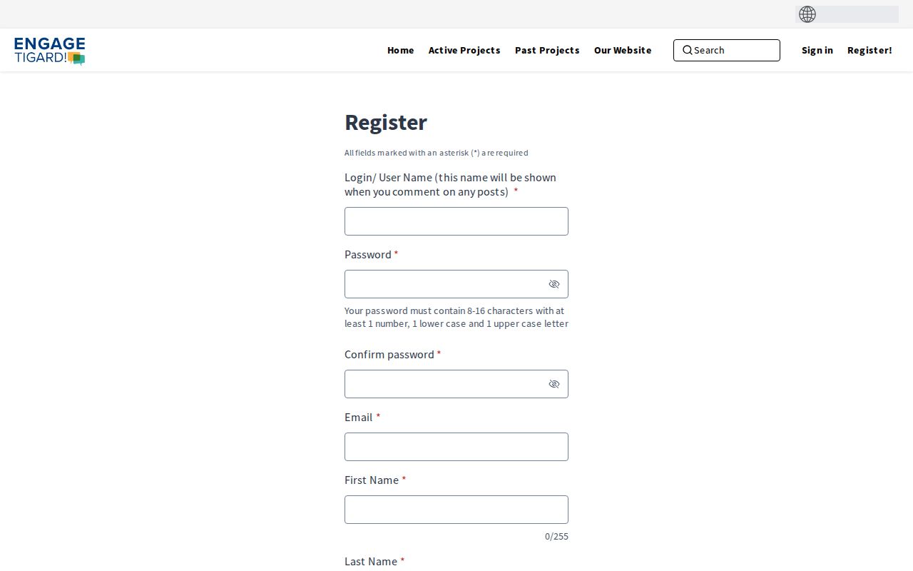
The choices orient a Tigard neighbors search to a civic area. They do not turn a map area into a resident, association, or membership directory.
| City neighborhood map and Engage | Use for civic-area and boundary context. Public materials do not provide household or member rosters. |
|---|---|
| Neighborhood Watch | The program recommends a one- to two-block area, a coordinator, and eight to ten participating households. |
| Neighborhood Watch contact | Maddie Bauer, 503-718-2814, maddie.bauer@tigard-or.gov. The program page describes private local contact lists and maps. |
| Community Roundtable | Public civic-organization contacts and event context, not a source for individual member names. |
Neighborhood Watch coordinators keep local names, addresses, phone numbers, email lists, and maps for participating households. Those are private participation materials. The Neighborhood Watch program is a useful route for learning how a block can organize, not a request route for another person’s contact list.
Tigard Neighbors: Official Records and Commercial Tools
Official records and commercial neighbor-lookup categories are built for different purposes. The county parcel and City map sources identify the public record, its custodian, and the limits of the data. Commercial compilation tools may combine public and purchased information, but their entries need independent confirmation and a removal request cannot erase the underlying government source. The Oregon Department of Justice points people to consumer privacy and data-broker routes when a covered private business is involved.
| Source Category | Useful For | Boundary |
|---|---|---|
| Official parcel, map, and recorder records | Checking a tax lot, legal description, assessment owner data, recorded instrument route, or public boundary | Owner and mailing fields do not prove every occupant; each source has its own access limits |
| City civic and Neighborhood Watch resources | Understanding a named area, program participation model, or public organizational contact | Not household rosters, association membership lists, or private coordinator contacts |
| Commercial compiled-neighbor category | A lead that must be checked against the custodian’s record | May be incomplete or inaccurate; an opt-out does not delete government records |
Oregon’s Consumer Privacy Act, ORS 646A.570 through 646A.589, applies to qualifying private businesses rather than government custodians. Oregon’s data-broker registration route can help identify a registered broker and its published opt-out narrative. It does not remove a Washington County deed, assessment record, or other lawfully retained public record.
Oregon My Vote Does Not List Tigard Neighbors
Oregon My Vote is an individual self-service tool for checking a person’s own registration, ballot status, county office, elected officials, and drop sites. Its documented initial workflow requires a name and date of birth, and the observed portal also required JavaScript and a CAPTCHA. It is not a name-only search or a way to browse nearby voters by street. Washington County Elections, not the City of Tigard, administers voter-registration records for Tigard residents.
Oregon law distinguishes My Vote from an official voter-list request. A requester may seek an electronic statewide or less-than-statewide list through the Secretary of State, subject to the statutory rules and exclusions. Protected and Address Confidentiality Program information is excluded, ballot choices remain secret, and ORS 247.955 prohibits commercial use of elector-list information. Those safeguards mean an election record should not be treated as a neighborhood list. The Washington County Elections office is the appropriate local administration route.
Privacy Limits When Checking Tigard Neighbors
Several important kinds of block information remain private. Parcel maps and assessment records do not supply renter names, all household members, utility or delivery customers, private Neighborhood Watch rosters, or DMV personal information. Oregon’s Address Confidentiality Program provides qualifying participants a substitute address and forward-mail path. Voter protections and public-record exemptions can also limit residential-address disclosure. A blank field or absent result should be treated as a boundary, not as permission to search around it.
The Oregon Public Records Law, ORS 192.311 through 192.478, provides a written-request path for records held by a public body, subject to exemptions and permitted actual-cost fees. It does not override privacy protections. For a personal-safety concern, consult the Oregon Department of Justice Address Confidentiality Program rather than attempting to locate protected address information.